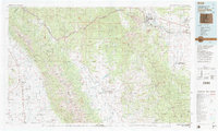
1982 Map of Canon City
USGS Topo · Published 1983About this map
Canon City and the Arkansas River valley anchor this 1982 survey of the high-altitude landscape between the Sangre de Cristo Mountains and the Wet Mountains. The map illustrates a complex network of ranching, mining, and institutional land use, specifically noting the State Prison Farm and various strip mines and gravel pits. The Denver and Rio Grande Western RR follows the river's path, serving the industrial corridor through Florence and Portland.
Find a feature on this map
134 named features on this map. Tap any name to fly to it.
Don’t see what you’re looking for? This feature index may not catch every label — zoom into the map to look around manually.
Map Details
Editions of this 1982 Canon City Map
This is the sole edition of this map. No revisions or reprints were ever made.
Other maps of this area

1889 · Canon City
USGS Topo · 1:125,000

1889 · Huerfano Park
USGS Topo · 1:125,000

1891 · Walsenburg
USGS Topo · 1:125,000

1891 · Pueblo
USGS Topo · 1:125,000

1892 · Huerfano Park
USGS Topo · 1:125,000

1892 · Canon City
USGS Topo · 1:125,000

1893 · Colorado Springs
USGS Topo · 1:125,000

1894 · Pikes Peak
USGS Topo · 1:125,000

1894 · Walsenburg
USGS Topo · 1:125,000

1894 · Pueblo
USGS Topo · 1:125,000