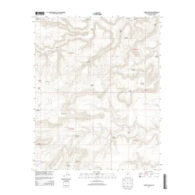
2013 Map of Canon Olguin
USGS Topo · Published 2013About this map
San Miguel Ranch Airport serves as a small aviation hub in this corner of San Miguel County, where the landscape is defined by an intricate network of drainages and mesas. The territory is carved by numerous canyons, including Cañon Olguin, Cañon Largo, and Cañon de las Yeguas. These deep-cut features, along with Trementina Cr and its tributaries like Arroyo Banco Quemado, demonstrate the complex erosional patterns typical of this New Mexico region.
Find a feature on this map
28 named features on this map. Tap any name to fly to it.
Don’t see what you’re looking for? This feature index may not catch every label — zoom into the map to look around manually.
Map Details
Editions of this 2013 Canon Olguin Map
This is the sole edition of this map. No revisions or reprints were ever made.
Other maps of this area

1892 · Watrous
USGS Topo · 1:125,000

1892 · Corazon
USGS Topo · 1:125,000

1894 · Corazon
USGS Topo · 1:125,000

1894 · Watrous
USGS Topo · 1:125,000

1954 · Santa Fe
USGS Topo · 1:250,000

1958 · Santa Fe
USGS Topo · 1:250,000

1971 · Trujillo
USGS Topo · 1:24,000

1971 · Canon Olguin
USGS Topo · 1:24,000

1972 · Variadero
USGS Topo · 1:24,000
1972 · Maes
USGS Topo · 1:24,000