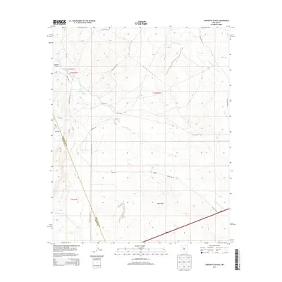
2013 Map of Canoncito School
USGS Topo · Published 2013About this map
Canoncito School serves as a central landmark in this high-desert landscape of the Eastern Navajo Agency, situated near the intersection of Canoncito School Rd and Terrace 7089. The terrain is defined by a series of dramatic drainages, including Cañada del Ojo and Cañada los Apaches, which carve through the plateau. These watercourses, along with Arroyo del Miranda and Sandoval Canyon, dictate the historical movement and settlement patterns of the region.
Find a feature on this map
22 named features on this map. Tap any name to fly to it.
Don’t see what you’re looking for? This feature index may not catch every label — zoom into the map to look around manually.
Map Details
Editions of this 2013 Canoncito School Map
This is the sole edition of this map. No revisions or reprints were ever made.
Other maps of this area

1883 · Mt. Taylor
USGS Topo · 1:250,000

1886 · Mt. Taylor
USGS Topo · 1:250,000

1888 · Bernalillo
USGS Topo · 1:125,000

1889 · Albuquerque
USGS Topo · 1:125,000

1892 · Mt. Taylor
USGS Topo · 1:250,000

1893 · Albuquerque
USGS Topo · 1:125,000

1899 · Mt. Taylor
USGS Topo · 1:250,000

1917 · Cerro Verde
USGS Topo · 1:125,000

1952 · Dalies NW
USGS Topo · 1:24,000

1954 · Herrera
USGS Topo · 1:24,000
Featured Places
- Eastern Navajo Agency, NM
- To'hajiilee, Eastern Navajo Agency
- Bernalillo County, NM
- Cibola County, NM
- United States