
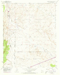
1954 Map of Canoncito School
USGS Topo · Published 1955About this map
The Canoncito Navajo Indian Reservation defines much of this high-desert landscape in the mid-1950s, split by the Bernalillo Co Valencia Co line. Institutional and industrial presence is centered around the Canoncito Navajo Day School and the resource extraction evidenced by the Canoncito Mine and the Fern Mine. The terrain is deeply carved by seasonal watercourses such as the Cañada de los Apaches and Cañada del Alamo, which dictate the placement of local infrastructure. Small-scale ranching and historic habitation are visible through the Herrera Ranch and documented Pueblo Ruins. A network of water management, indicated by various Windmill and Water Tank sites, reflects the essential needs of the Laguna Indian Reservation territory during this era of post-war development in the New Mexico backcountry.
Find a feature on this map
19 named features on this map. Tap any name to fly to it.
Don’t see what you’re looking for? This feature index may not catch every label — zoom into the map to look around manually.
Map Details
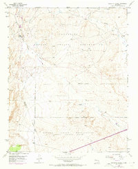
Editions of this 1954 Canoncito School Map
3 editions found
Other maps of this area

1883 · Mt. Taylor
USGS Topo · 1:250,000

1886 · Mt. Taylor
USGS Topo · 1:250,000

1888 · Bernalillo
USGS Topo · 1:125,000

1889 · Albuquerque
USGS Topo · 1:125,000

1892 · Mt. Taylor
USGS Topo · 1:250,000

1893 · Albuquerque
USGS Topo · 1:125,000

1899 · Mt. Taylor
USGS Topo · 1:250,000

1917 · Cerro Verde
USGS Topo · 1:125,000

1952 · Dalies NW
USGS Topo · 1:24,000

1954 · Herrera
USGS Topo · 1:24,000
Featured Places
- Eastern Navajo Agency, NM
- To'hajiilee, Eastern Navajo Agency
- Bernalillo County, NM
- Cibola County, NM
- United States