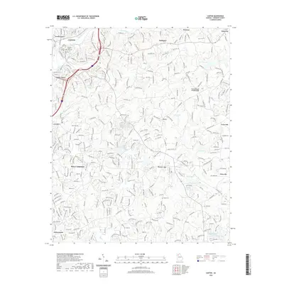
2020 Map of Canton
USGS Topo · Published 2020About this map
The Etowah River carves through the northern landscape of Cherokee County, framing the administrative and commercial heart of Canton. This 2020 edition documents the suburban development and infrastructure of the region, from the Cherokee County Courthouse in the historic center to the growing residential areas of North Canton and South Canton. The map reveals a transition from the structured street grid of the county seat to the winding roads of unincorporated communities such as Buffington and Hickory Flat. For genealogists and local historians, several family-named landmarks and resting places are preserved in the data, including River View Cem near the riverbanks and Pugh Cem to the east. The terrain is marked by numerous small lakes and creeks, such as Garrison Lake and Canton Cr, which have historically influenced the settlement patterns of nearby hamlets like Univeter and Avery.
Find a feature on this map
85 named features on this map. Tap any name to fly to it.
Don’t see what you’re looking for? This feature index may not catch every label — zoom into the map to look around manually.
Map Details
Editions of this 2020 Canton Map
This is the sole edition of this map. No revisions or reprints were ever made.
Other maps of this area

1890 · Suwanee
USGS Topo · 1:125,000

1890 · Cartersville
USGS Topo · 1:125,000

1891 · Cartersville
USGS Topo · 1:125,000

1894 · Suwanee
USGS Topo · 1:125,000

1896 · Cartersville
USGS Topo · 1:125,000

1907 · Acworth
USGS Topo · 1:62,500

1909 · Acworth
USGS Topo · 1:62,500

1926 · Tate
USGS Topo · 1:62,500

1928 · Tate
USGS Topo · 1:62,500

1947 · Waleska
USGS Topo · 1:62,500