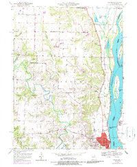
1950 Map of Canton
USGS Topo · Published 1986About this map
Canton serves as a prominent riverfront hub along the Mississippi River in this mid-century survey, which details the complex hydraulic and educational landscape of northeastern Missouri. The campus of Culver-Stockton College overlooks the town, while the river itself is managed by Lock & Dam No 20 and a Gaging Sta. The lowlands are defined by a series of significant river islands, including Tully Island, White Island, and Huff Island, alongside the Burlington Northern railroad corridor.
Find a feature on this map
50 named features on this map. Tap any name to fly to it.
Don’t see what you’re looking for? This feature index may not catch every label — zoom into the map to look around manually.
Map Details
Editions of this 1950 Canton Map
3 editions found

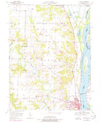
Other maps of this area

1903 · Kahoka
USGS Topo · 1:125,000

1936 · Keokuk
USGS Topo · 1:62,500

1946 · Mendon
USGS Topo · 1:62,500

1948 · Mendon
USGS Topo · 1:62,500

1949 · Kahoka SE
USGS Topo · 1:24,000

1949 · St. Patrick
USGS Topo · 1:24,000

1950 · Saint Patrick
USGS Topo · 1:24,000

1950 · Kahoka SE
USGS Topo · 1:24,000

1950 · Keokuk
USGS Topo · 1:62,500

1950 · La Grange
USGS Topo · 1:24,000