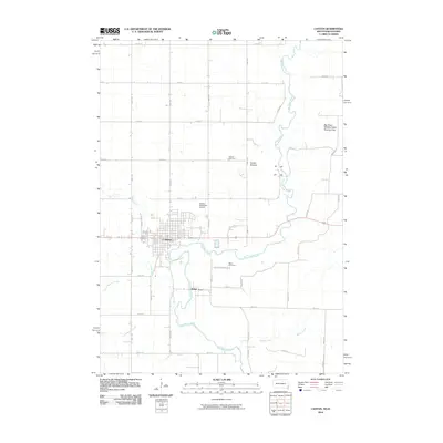
2010 Map of Canton
USGS Topo · Published 2010About this map
Canton serves as a prominent hub in this 2010 landscape, situated along a bend in the Big Sioux River where the borders of South Dakota and Iowa meet. The town's grid is well-established, supported by the Canton Municipal Airport and a network of section-line roads like 482nd Ave. Cultural and historical markers are concentrated near the river, including the Canton Mounds and the Canton Cemetery, while the smaller settlement of Beloit sits just to the south across the water. The surrounding area is defined by a dense drainage system where Beaver Creek and Little Beaver Creek feed into the river, alongside the Big Sioux Wildlife Public Hunting Area to the northeast. This survey illustrates the persistent agricultural and river-oriented layout of Lincoln County, highlighting the geographic importance of the river as both a state boundary and a focal point for local cemeteries and landmarks.
Find a feature on this map
40 named features on this map. Tap any name to fly to it.
Don’t see what you’re looking for? This feature index may not catch every label — zoom into the map to look around manually.
Map Details
Editions of this 2010 Canton Map
This is the sole edition of this map. No revisions or reprints were ever made.
Other maps of this area

1897 · Canton
USGS Topo · 1:125,000

1900 · Canton
USGS Topo · 1:125,000

1955 · Sioux Falls
USGS Topo · 1:250,000

1958 · Sioux Falls
USGS Topo · 1:250,000

1962 · Klondike
USGS Topo · 1:24,000

1962 · Harrisburg
USGS Topo · 1:24,000

1962 · Canton
USGS Topo · 1:24,000

1964 · Canton SW
USGS Topo · 1:24,000

1968 · Alcester NW
USGS Topo · 1:24,000

1968 · Alcester NE
USGS Topo · 1:24,000