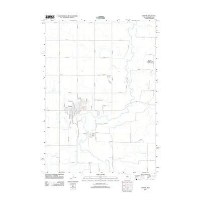
2012 Map of Canton
USGS Topo · Published 2012About this map
Canton stands as the primary settlement on this Lincoln County landscape, situated where the grid of city streets meets the winding path of Beaver Cr. The map details the residential and civic structure of the town, from the centrally located Po to the Canton Municipal Airport on the eastern outskirts. To the south, the smaller community of Beloit is connected by Beloit Cemetery Rd, leading past its namesake Beloit Cem.
Find a feature on this map
67 named features on this map. Tap any name to fly to it.
Don’t see what you’re looking for? This feature index may not catch every label — zoom into the map to look around manually.
Map Details
Editions of this 2012 Canton Map
This is the sole edition of this map. No revisions or reprints were ever made.
Other maps of this area

1897 · Canton
USGS Topo · 1:125,000

1900 · Canton
USGS Topo · 1:125,000

1955 · Sioux Falls
USGS Topo · 1:250,000

1958 · Sioux Falls
USGS Topo · 1:250,000

1962 · Klondike
USGS Topo · 1:24,000

1962 · Harrisburg
USGS Topo · 1:24,000

1962 · Canton
USGS Topo · 1:24,000

1964 · Canton SW
USGS Topo · 1:24,000

1968 · Alcester NW
USGS Topo · 1:24,000

1968 · Alcester NE
USGS Topo · 1:24,000