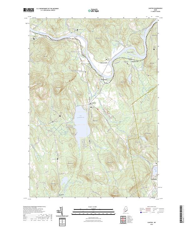
2024 Map of Canton
USGS Topo · Published 2024About this map
The Androscoggin River carves a winding path through this corner of Oxford County, defining the valley where settlements like Canton Point, Gilbertville, and Canton took root. The industrial and transport history of the region is etched into the landscape via the Old Railroad Grade that parallels the river and Bog Brook. Central to the area's geography is Lake Anasagunticook, a large water body surrounded by named peaks and ridges such as The Pinnacle, Staples Hill, and Dunn Ledge.
Find a feature on this map
109 named features on this map. Tap any name to fly to it.
Don’t see what you’re looking for? This feature index may not catch every label — zoom into the map to look around manually.
Map Details
Editions of this 2024 Canton Map
This is the sole edition of this map. No revisions or reprints were ever made.
Other maps of this area

1910 · Livermore
USGS Topo · 1:62,500

1911 · Buckfield
USGS Topo · 1:62,500

1912 · Livermore
USGS Topo · 1:62,500

1913 · Buckfield
USGS Topo · 1:62,500

1924 · Farmington
USGS Topo · 1:62,500

1926 · Dixfield
USGS Topo · 1:62,500

1929 · Dixfield
USGS Topo · 1:62,500

1941 · Livermore
USGS Topo · 1:62,500

1942 · Buckfield
USGS Topo · 1:62,500

1950 · Lewiston
USGS Topo · 1:250,000