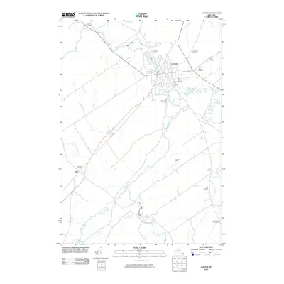
2010 Map of Canton
USGS Topo · Published 2010About this map
Canton serves as the focal point of this North Country landscape, where the Grass River snakes through the village center. The area is defined by its educational and civic institutions, most notably the campus of Saint Lawrence University and nearby Hurlbut Field. Outside the village core, the map reveals a collection of smaller settlements like Pyrites and Eddy, connected by a network of rural roads and watercourses such as Little River and Harrison Creek. The geographic distribution of burial grounds, including Evergreen Cemetery, Fairview Cemetery, and Saint Marys Cemetery, provides significant data for genealogical research across the township. Further downstream, Rushton Falls marks a distinct point along the river's path, while the northern reaches include Upper Lake and the Norton Cemetery, illustrating the transition from the concentrated village center to the outlying agricultural and wooded regions of Saint Lawrence County.
Find a feature on this map
25 named features on this map. Tap any name to fly to it.
Don’t see what you’re looking for? This feature index may not catch every label — zoom into the map to look around manually.
Map Details
Editions of this 2010 Canton Map
This is the sole edition of this map. No revisions or reprints were ever made.
Other maps of this area

1904 · Ogdensburg
USGS Topo · 1:62,500

1905 · Ogdensburg
USGS Topo · 1:62,500

1910 · Canton
USGS Topo · 1:62,500

1911 · Canton
USGS Topo · 1:62,500

1915 · Gouverneur
USGS Topo · 1:62,500

1915 · Russell
USGS Topo · 1:62,500

1918 · Russell
USGS Topo · 1:62,500

1937 · Gouverneur
USGS Topo · 1:62,500

1943 · Rensselaer Falls
USGS Topo · 1:31,680

1943 · Lisbon
USGS Topo · 1:31,680