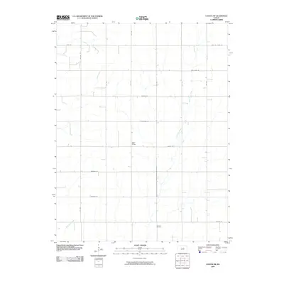
2009 Map of Canton SW
USGS Topo · Published 2009About this map
Meridian Cemetery stands as a quiet focal point in this portion of McPherson County, anchoring a landscape defined by the orderly grid of section lines and prairie drainages. The area is marked by the presence of the Spring Valley Oil Field, reflecting the importance of energy extraction in the local economy during the early 21st century. Natural waterways, including the winding course of Sand Creek and the headwaters of West Emma Creek and Black Kettle Creek, cut across the surveyed roads, creating subtle variations in the agricultural plains. Many of the thoroughfares here, such as Chisholm Rd, Cimarron Rd, and Iron Horse Rd, carry names that evoke the regional history of cattle drives, western trails, and the steam era, even as they serve modern farm-to-market functions.
Find a feature on this map
19 named features on this map. Tap any name to fly to it.
Don’t see what you’re looking for? This feature index may not catch every label — zoom into the map to look around manually.
Map Details
Editions of this 2009 Canton SW Map
This is the sole edition of this map. No revisions or reprints were ever made.
Other maps of this area

1889 · Newton
USGS Topo · 1:125,000

1891 · Hutchinson
USGS Topo · 1:125,000

1893 · Hutchinson
USGS Topo · 1:125,000

1894 · Newton
USGS Topo · 1:125,000

1955 · Hutchinson
USGS Topo · 1:250,000

1959 · Hutchinson
USGS Topo · 1:250,000

1965 · Goessel
USGS Topo · 1:24,000

1965 · Galva
USGS Topo · 1:24,000
1965 · Mc Pherson SE
USGS Topo · 1:24,000
1965 · Hesston
USGS Topo · 1:24,000