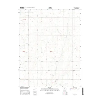
2015 Map of Canton SW
USGS Topo · Published 2015About this map
Running Turkey Cr and Sand Cr carve through this agricultural landscape in McPherson County, defining the drainage patterns that shaped the local section lines and farmstead placement. This 2015 survey illustrates a grid of arterial roads named for regional history and heritage, including Chisholm Rd, Cimarron Rd, and Kiowa Rd. Genealogists will find the locations of Lone Tree Cem and Meridian Cem, which serve as permanent markers of the area's early settlement families. The eastern half of the map is dominated by the meandering course of W Emma Cr, while the southern reaches are touched by Black Kettle Cr. The infrastructure remains firmly rooted in the Public Land Survey System, with numbered avenues from 24th Ave to 29th Ave maintaining the orderly transition from the prairie into organized ranching and cultivation.
Find a feature on this map
27 named features on this map. Tap any name to fly to it.
Don’t see what you’re looking for? This feature index may not catch every label — zoom into the map to look around manually.
Map Details
Editions of this 2015 Canton SW Map
This is the sole edition of this map. No revisions or reprints were ever made.
Other maps of this area

1889 · Newton
USGS Topo · 1:125,000

1891 · Hutchinson
USGS Topo · 1:125,000

1893 · Hutchinson
USGS Topo · 1:125,000

1894 · Newton
USGS Topo · 1:125,000

1955 · Hutchinson
USGS Topo · 1:250,000

1959 · Hutchinson
USGS Topo · 1:250,000

1965 · Goessel
USGS Topo · 1:24,000

1965 · Galva
USGS Topo · 1:24,000
1965 · Mc Pherson SE
USGS Topo · 1:24,000
1965 · Hesston
USGS Topo · 1:24,000