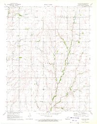
1971 Map of Canton SW
USGS Topo · Published 1972About this map
Spring Valley Creek and Running Turkey Creek wind through this rural landscape in McPherson County, recorded during a 1971 field check. The area is defined by the organized grid of the Canton, Spring Valley, and Meridian townships, where agriculture and early energy extraction intersect. Scattered Oil Wells appear across the northern sections, particularly near the township boundary of Empire. This map provides significant detail for family historians, documenting the exact locations of local social hubs including Sunny Hill Sch and Spring Valley Sch. Religious and community life is anchored by several rural congregations, such as Immanuel Ch, Lone Tree Ch, and Spring Valley Ch. Small family and community burial grounds, including Meridian Cem, are clearly marked alongside watercourses like Black Kettle Creek and Sand Creek.
Find a feature on this map
24 named features on this map. Tap any name to fly to it.
Don’t see what you’re looking for? This feature index may not catch every label — zoom into the map to look around manually.
Map Details
Editions of this 1971 Canton SW Map
2 editions found
Other maps of this area

1889 · Newton
USGS Topo · 1:125,000

1891 · Hutchinson
USGS Topo · 1:125,000

1893 · Hutchinson
USGS Topo · 1:125,000

1894 · Newton
USGS Topo · 1:125,000

1955 · Hutchinson
USGS Topo · 1:250,000

1959 · Hutchinson
USGS Topo · 1:250,000

1965 · Goessel
USGS Topo · 1:24,000

1965 · Galva
USGS Topo · 1:24,000
1965 · Mc Pherson SE
USGS Topo · 1:24,000
1965 · Hesston
USGS Topo · 1:24,000