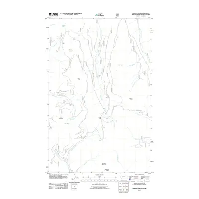
2011 Map of Canuck Peak
USGS Topo · Published 2011About this map
Copper Mountain and Ruby Mountain anchor this high-altitude landscape in Lincoln County, where the U.S. Forest Service manages a complex network of access roads for resource management and recreation. The terrain is defined by dramatic ridgelines including Copper Ridge, Ruby Ridge, and Buckhorn Ridge, which separate the drainages of Copper Creek and Deer Creek. Small alpine waters like Copper Lake and Spruce Lake sit tucked below these peaks, while Canuck Pass provides a transition point between the watersheds of Canuck Creek and Hellroaring Creek. The map documents a modern infrastructure of forest development roads, such as the Copper Connection Rd and Copper Saddle Rd, which facilitate movement through this section of the Kootenai National Forest area.
Find a feature on this map
38 named features on this map. Tap any name to fly to it.
Don’t see what you’re looking for? This feature index may not catch every label — zoom into the map to look around manually.
Map Details
Editions of this 2011 Canuck Peak Map
This is the sole edition of this map. No revisions or reprints were ever made.
Other maps of this area

1911 · Priest Lake
USGS Topo · 1:250,000

1913 · Priest Lake
USGS Topo · 1:250,000

1957 · Kalispell
USGS Topo · 1:250,000

1958 · Sandpoint
USGS Topo · 1:250,000

1960 · Kalispell
USGS Topo · 1:250,000

1961 · Kalispell
USGS Topo · 1:250,000

1963 · Sandpoint
USGS Topo · 1:250,000

1963 · Mount Baldy
USGS Topo · 1:24,000

1963 · Northwest Peak
USGS Topo · 1:24,000

1965 · Meadow Creek
USGS Topo · 1:24,000