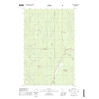
2020 Map of Canuck Peak
USGS Topo · Published 2020About this map
Purcell Mountains terrain dominates this 2020 survey of the borderlands between Montana and Idaho. The map traces the high-elevation divide where the Kaniksu National Forest meets the Kootenai National Forest, a landscape defined by significant peaks such as Canuck Peak and Ruby Mtn. This area is a critical corridor for long-distance recreation, featuring a segment of the Pacific NW National Scenic Trail as it winds past Canuck Pass and north toward the international boundary.
Find a feature on this map
52 named features on this map. Tap any name to fly to it.
Don’t see what you’re looking for? This feature index may not catch every label — zoom into the map to look around manually.
Map Details
Editions of this 2020 Canuck Peak Map
This is the sole edition of this map. No revisions or reprints were ever made.
Other maps of this area

1911 · Priest Lake
USGS Topo · 1:250,000

1913 · Priest Lake
USGS Topo · 1:250,000

1957 · Kalispell
USGS Topo · 1:250,000

1958 · Sandpoint
USGS Topo · 1:250,000

1960 · Kalispell
USGS Topo · 1:250,000

1961 · Kalispell
USGS Topo · 1:250,000

1963 · Sandpoint
USGS Topo · 1:250,000

1963 · Mount Baldy
USGS Topo · 1:24,000

1963 · Northwest Peak
USGS Topo · 1:24,000

1965 · Meadow Creek
USGS Topo · 1:24,000