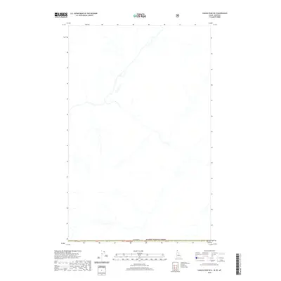
2020 Map of Canuck Peak OE N
USGS Topo · Published 2020About this map
Kaniksu National Forest defines the southern portion of this high-altitude landscape where the United States meets the international border. This map documents a remote transition zone along the boundary with Canada, centered on a network of high-elevation watercourses that feed into larger regional watersheds. The terrain is structured by the Public Land Survey System, specifically marking T65n R3e, and includes several numbered public land markers such as pb37, pb38, and pb39 that line the international frontier. The lack of named settlements or roads emphasizes the wilderness character of the region during the late twenty-teens and early 2020s, serving as a record of undeveloped forest lands and drainage patterns in this corner of the Pacific Northwest.
Find a feature on this map
9 named features on this map. Tap any name to fly to it.
Don’t see what you’re looking for? This feature index may not catch every label — zoom into the map to look around manually.
Map Details
Editions of this 2020 Canuck Peak OE N Map
This is the sole edition of this map. No revisions or reprints were ever made.
Other maps of this area

1911 · Priest Lake
USGS Topo · 1:250,000

1913 · Priest Lake
USGS Topo · 1:250,000

1957 · Kalispell
USGS Topo · 1:250,000

1958 · Sandpoint
USGS Topo · 1:250,000

1960 · Kalispell
USGS Topo · 1:250,000

1961 · Kalispell
USGS Topo · 1:250,000

1963 · Sandpoint
USGS Topo · 1:250,000

1963 · Northwest Peak
USGS Topo · 1:24,000

1965 · Eastport
USGS Topo · 1:24,000
1965 · Canuck Peak
USGS Topo · 1:24,000