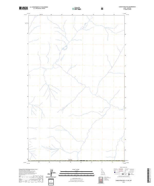
2024 Map of Canuck Peak OE N
USGS Topo · Published 2024About this map
Canada forms the northern boundary of this high-elevation landscape, where the international border is demarcated by a series of precise markers. This 2024 U.S. Geological Survey sheet provides an intricate look at the headwaters and drainage networks flowing south from the border, illustrating the complex hydrology of the Boundary County region. The map captures the intersection of several public land survey divisions, including T65n-R3e and T37n-R34w, providing essential data for property research and land management. The presence of specific boundary points such as Pb40, Pb39, and Pb38 highlights the ongoing administrative record-keeping of this remote frontier. This edition integrates recent National Hydrography and Elevation datasets to document the current state of the terrain.
Find a feature on this map
7 named features on this map. Tap any name to fly to it.
Don’t see what you’re looking for? This feature index may not catch every label — zoom into the map to look around manually.
Map Details
Editions of this 2024 Canuck Peak OE N Map
This is the sole edition of this map. No revisions or reprints were ever made.
Other maps of this area

1911 · Priest Lake
USGS Topo · 1:250,000

1913 · Priest Lake
USGS Topo · 1:250,000

1957 · Kalispell
USGS Topo · 1:250,000

1958 · Sandpoint
USGS Topo · 1:250,000

1960 · Kalispell
USGS Topo · 1:250,000

1961 · Kalispell
USGS Topo · 1:250,000

1963 · Sandpoint
USGS Topo · 1:250,000

1963 · Northwest Peak
USGS Topo · 1:24,000

1965 · Eastport
USGS Topo · 1:24,000
1965 · Canuck Peak
USGS Topo · 1:24,000