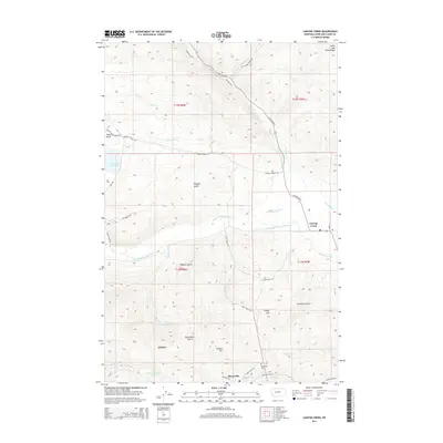
2014 Map of Canyon Creek
USGS Topo · Published 2014About this map
Marysville and the surrounding peaks of the Lewis and Clark Range define this high-altitude landscape in central Montana. This terrain is marked by numerous drainages and irrigation works, such as the Gans Klein Ditch and Grady Ditch, which reflect the historical necessity of water management in the region's semi-arid environment. The settlement of Gloster and the village of Canyon Creek sit alongside a complex network of gulches, including Missouri Gulch and Drinkwater Gulch, suggesting a history of prospecting or ranching. Genealogists and local historians will find value in the location of the Marysville Cem, situated near the confluence of Silver Cr and Jennies Fork. The map also details early 21st-century infrastructure, such as Highway 279, winding through the mountains toward the Little Prickly Pear Cr drainage.
Find a feature on this map
46 named features on this map. Tap any name to fly to it.
Don’t see what you’re looking for? This feature index may not catch every label — zoom into the map to look around manually.
Map Details
Editions of this 2014 Canyon Creek Map
This is the sole edition of this map. No revisions or reprints were ever made.
Other maps of this area

1889 · Helena
USGS Topo · 1:250,000

1893 · Helena
USGS Topo · 1:250,000

1899 · Helena
USGS Topo · 1:250,000

1903 · Helena
USGS Topo · 1:250,000

1947 · Butte
USGS Topo · 1:250,000

1950 · Helena
USGS Topo · 1:62,500

1958 · Butte
USGS Topo · 1:250,000

1959 · Elliston
USGS Topo · 1:62,500

1960 · Butte
USGS Topo · 1:250,000

1962 · Butte
USGS Topo · 1:250,000