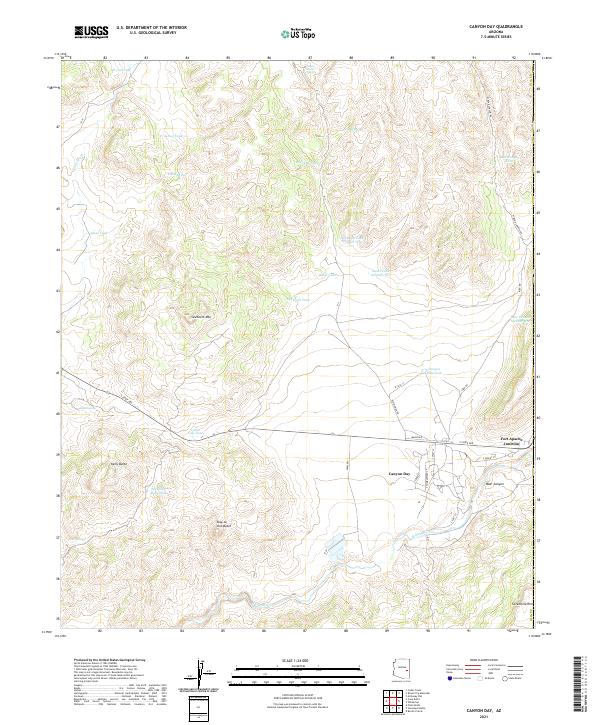
2021 Map of Canyon Day
USGS Topo · Published 2021About this map
The Canyon Day settlement and Fort Apache Junction serve as focal points for this eastern Arizona landscape, where the White River flows through the southern reaches of the quadrangle. The terrain is defined by prominent high points such as Sawtooth Mtn, Kelly Butte, and Tsay-se-zhin Butte, with the land rising toward the Sevenmile Rim at the southeastern edge. Water management is a central feature of the map, evidenced by a dense network of tanks including Kinishba Tank, Cedar Gap Tank, and Ruins Tank Number Two. These features, along with natural water sources like Amos Spring and Yellow Jacket Spring, suggest a landscape historically shaped by ranching or land management in a dry environment. A localized grid of streets in the town site, including S Sunset St and Clover St, contrasts with the winding backcountry roads such as W Bear Canyon Rd that navigate the ridges and canyons.
Find a feature on this map
49 named features on this map. Tap any name to fly to it.
Don’t see what you’re looking for? This feature index may not catch every label — zoom into the map to look around manually.
Map Details
Editions of this 2021 Canyon Day Map
This is the sole edition of this map. No revisions or reprints were ever made.
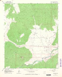
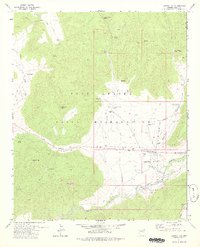
Historical Maps of Fort Apache Junction Through Time
3 maps found