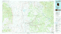
1984 Map of Canyon De Chelly
USGS Topo · Published 1984About this map
The Navajo Indian Reservation spans this high desert landscape in the mid-1980s, centered on the complex drainage of the Chinle Wash. The map documents a period of institutional growth and enduring commerce, featuring the Navajo Community College at Tsaile and established outposts like the Many Farms Trading Post and Upper Greasewood Trading Post.
Find a feature on this map
43 named features on this map. Tap any name to fly to it.
Don’t see what you’re looking for? This feature index may not catch every label — zoom into the map to look around manually.
Map Details
Editions of this 1984 Canyon De Chelly Map
This is the sole edition of this map. No revisions or reprints were ever made.
Other maps of this area

1883 · Marsh Pass
USGS Topo · 1:250,000

1883 · Tusayan
USGS Topo · 1:250,000

1886 · Wingate
USGS Topo · 1:250,000

1886 · Tusayan
USGS Topo · 1:250,000

1886 · Fort Defiance
USGS Topo · 1:250,000

1889 · Chaco
USGS Topo · 1:250,000

1892 · Fort Defiance
USGS Topo · 1:250,000

1892 · Marsh Pass
USGS Topo · 1:250,000

1892 · Wingate
USGS Topo · 1:250,000

1892 · Chaco
USGS Topo · 1:250,000