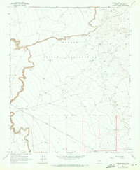
1968 Map of Canyon Diablo
USGS Topo · Published 1971About this map
The Navajo Indian Reservation covers the northern half of this landscape, its boundary following the southern rim of the dramatic gorge carved by Canyon Diablo. Along the southern reaches of the canyon, evidence of early habitation and passage is preserved in the form of Ruins and scattered Graves near the canyon floor. This area represents a critical corridor for transcontinental transit, as the Atchison Topeka and Santa Fe railroad tracks cut directly across the high desert flats through the station at Sunshine. The relationship between the deep incision of Padre Canyon and the open plateau reflects the challenging topography that influenced both rail engineering and indigenous settlement patterns in this part of Coconino County during the late 1960s.
Find a feature on this map
15 named features on this map. Tap any name to fly to it.
Don’t see what you’re looking for? This feature index may not catch every label — zoom into the map to look around manually.
Map Details
Editions of this 1968 Canyon Diablo Map
2 editions found
Other maps of this area

1883 · Tusayan
USGS Topo · 1:250,000

1886 · Tusayan
USGS Topo · 1:250,000

1886 · San Francisco Mtns
USGS Topo · 1:250,000

1891 · San Francisco Mtns
USGS Topo · 1:250,000

1894 · San Francisco Mtns
USGS Topo · 1:250,000

1899 · San Francisco Mtns
USGS Topo · 1:250,000

1947 · Flagstaff
USGS Topo · 1:250,000

1954 · Flagstaff
USGS Topo · 1:250,000

1955 · Winslow 2 SW
USGS Topo · 1:24,000

1955 · Leupp
USGS Topo · 1:62,500