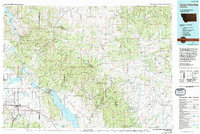
1975 Map of Canyon Ferry Dam
USGS Topo · Published 1994About this map
The Missouri River corridor serves as the central artery of this region, dominated by the massive waters of Canyon Ferry Lake and Hauser Lake. This mid-1970s survey captures the landscape during a period of established hydroelectric development, anchored by the Canyon Ferry Dam and Hauser Dam. Industrial and transit hubs such as East Helena and Montana City show the area's growth, supported by the Burlington Northern railroad lines. To the east, the Big Belt Mountains rise sharply, dotted with mining history at the Schabert Mine and Humming Bird Mine. The map also delineates the protected expanse of the Gates of the Mountains Wilderness Area, where the river cuts through high limestone cliffs north of Upper Holter Lake. From the small settlement of York to the Helena Valley Regulating Reservoir, the sheet reveals the complex management of water and minerals in the Montana interior.
Find a feature on this map
63 named features on this map. Tap any name to fly to it.
Don’t see what you’re looking for? This feature index may not catch every label — zoom into the map to look around manually.
Map Details
Editions of this 1975 Canyon Ferry Dam Map
This is the sole edition of this map. No revisions or reprints were ever made.
Other maps of this area

1886 · Great Falls
USGS Topo · 1:250,000

1886 · Fort Logan
USGS Topo · 1:250,000

1886 · Little Belt Mts.
USGS Topo · 1:250,000

1889 · Helena
USGS Topo · 1:250,000

1890 · Fort Benton
USGS Topo · 1:250,000

1892 · Fort Benton
USGS Topo · 1:250,000

1893 · Helena
USGS Topo · 1:250,000

1894 · Little Belt Mts.
USGS Topo · 1:250,000

1897 · Fort Benton
USGS Topo · 1:250,000

1897 · Little Belt Mts.
USGS Topo · 1:250,000