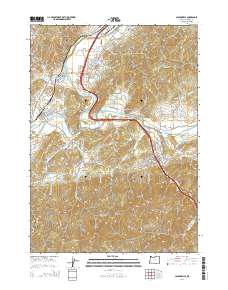
2014 Map of Canyonville
USGS Topo · Published 2014About this map
Canyonville and Riddle anchor this 2014 survey of southern Douglas County, where the South Umpqua River and Cow Creek carve through the foothills of the Umpqua National Forest region. The map captures a landscape defined by the intersection of early pioneer history and modern infrastructure. Genealogists will find significant local value in the presence of the Pioneer Cem, Canyonville Cem, and the William D Bradley Cem, providing precise locations for ancestral research in these long-established communities. The industrial character of the era is evident in the numerous mill-related features, including Keystone Log Pond, Corder Log Pond, and Herbert Log Pond. Transportation corridors are clearly delineated, showing the alignment of the Tiller Trail Hwy and N Old Pacific Hwy as they follow the natural contours of the river valleys. Elevation details highlight prominent landmarks such as Tellurium Peak and Canyon Mtn, overlooking Surprise Valley and the northern reaches of the Myrtle Creek Municipal Airport.
Find a feature on this map
54 named features on this map. Tap any name to fly to it.
Don’t see what you’re looking for? This feature index may not catch every label — zoom into the map to look around manually.
Map Details
Editions of this 2014 Canyonville Map
This is the sole edition of this map. No revisions or reprints were ever made.
Other maps of this area

1897 · Roseburg
USGS Topo · 1:125,000

1900 · Roseburg
USGS Topo · 1:125,000

1904 · Riddle
USGS Topo · 1:125,000

1954 · Dixonville
USGS Topo · 1:62,500

1954 · Days Creek
USGS Topo · 1:62,500

1954 · Canyonville
USGS Topo · 1:62,500

1955 · Roseburg
USGS Topo · 1:62,500

1955 · Medford
USGS Topo · 1:250,000

1957 · Medford
USGS Topo · 1:250,000

1958 · Medford
USGS Topo · 1:250,000