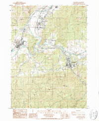
1986 Map of Canyonville
USGS Topo · Published 1986About this map
The South Umpqua River and Cow Creek converge in this mid-1980s landscape of southern Douglas County, where industrial sites and timber-access ridges meet riverside settlements. The timber and mineral economy is evident through several mining operations south of the river, including the Levens Ledge Mine, Gold Bluff Mine, and the curiously named Thuckleberry Mine near Tellurium Peak.
Find a feature on this map
68 named features on this map. Tap any name to fly to it.
Don’t see what you’re looking for? This feature index may not catch every label — zoom into the map to look around manually.
Map Details
Editions of this 1986 Canyonville Map
This is the sole edition of this map. No revisions or reprints were ever made.
Other maps of this area

1897 · Roseburg
USGS Topo · 1:125,000

1900 · Roseburg
USGS Topo · 1:125,000

1904 · Riddle
USGS Topo · 1:125,000

1954 · Dixonville
USGS Topo · 1:62,500

1954 · Days Creek
USGS Topo · 1:62,500

1954 · Canyonville
USGS Topo · 1:62,500

1955 · Roseburg
USGS Topo · 1:62,500

1955 · Medford
USGS Topo · 1:250,000

1957 · Medford
USGS Topo · 1:250,000

1958 · Medford
USGS Topo · 1:250,000