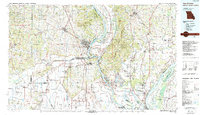
1986 Map of Cape Girardeau
USGS Topo · Published 1986About this map
The confluence of the Mississippi River and Ohio River creates a dynamic landscape of islands and rich bottomlands at the tri-state junction of Missouri, Illinois, and Kentucky. This mid-1980s topographical study highlights the dense rail network supporting the region's river economy, including the St Louis Southwestern Railway and the Illinois Central Gulf Railroad. Settlement patterns reflect the diverse geography, from riverfront towns like Commerce and Scott City to upland communities such as Pocahontas, Burfordville, and Oak Ridge.
Find a feature on this map
130 named features on this map. Tap any name to fly to it.
Don’t see what you’re looking for? This feature index may not catch every label — zoom into the map to look around manually.
Map Details
Editions of this 1986 Cape Girardeau Map
This is the sole edition of this map. No revisions or reprints were ever made.
Other maps of this area

1910 · Higdon
USGS Topo · 1:62,500

1918 · Altenburg
USGS Topo · 1:62,500

1918 · Vienna
USGS Topo · 1:62,500

1919 · Vienna
USGS Topo · 1:62,500

1920 · Jonesboro
USGS Topo · 1:62,500

1920 · Dongola
USGS Topo · 1:62,500

1922 · Carbondale
USGS Topo · 1:62,500

1922 · Cape Girardeau
USGS Topo · 1:62,500

1923 · Dongola
USGS Topo · 1:62,500

1923 · Jonesboro
USGS Topo · 1:62,500