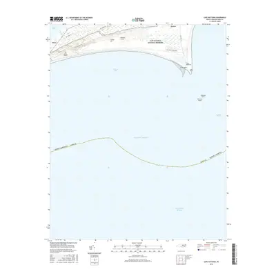
2016 Map of Cape Hatteras
USGS Topo · Published 2016About this map
Cape Hatteras defines this coastal landscape where the Outer Banks make a sharp turn into the Atlantic Ocean. The barrier island environment is shaped by high ridges such as Piney Ridge and Creeds Hill, providing a backdrop to the settlements of Buxton and Frisco. A significant portion of the land is preserved within the Cape Hatteras National Seashore, which includes local infrastructure like the Billy Mitchell Airport and the Cape Point Campground. To the east, the treacherous waters of Diamond Shoals and Hatteras Shoals extend from Cape Point, marking the transition from the sheltered Pamlico Sound to the open sea. The map traces the essential road network, including Lighthouse Rd and Billy Mitchell Rd, which serve as the primary conduits for this narrow stretch of Hatteras Island.
Find a feature on this map
24 named features on this map. Tap any name to fly to it.
Don’t see what you’re looking for? This feature index may not catch every label — zoom into the map to look around manually.
Map Details
Editions of this 2016 Cape Hatteras Map
This is the sole edition of this map. No revisions or reprints were ever made.
Other maps of this area

1948 · Cape Hatteras
USGS Topo · 1:24,000

1948 · Buxton
USGS Topo · 1:24,000

1950 · Cape Hatteras
USGS Topo · 1:24,000

1950 · Buxton
USGS Topo · 1:24,000

1955 · Wanchese
USGS Topo · 1:250,000

1957 · Manteo
USGS Topo · 1:250,000

1960 · Manteo
USGS Topo · 1:250,000

1985 · Cape Hatteras
USGS Topo · 1:100,000

2002 · Cape Hatteras
USGS Topo · 1:24,000

2011 · Buxton
USGS Topo · 1:24,000