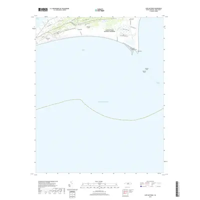
2019 Map of Cape Hatteras
USGS Topo · Published 2019About this map
Hatteras Island dominates this 2019 survey, showcasing the dynamic coastline of the Outer Banks at the elbow of Cape Point. The interior landscape is defined by a dense network of trails such as the Buxton Woods Trail and Piney Ridge Trail, which weave through the vegetated dunes of the Cape Hatteras National Seashore. A poignant reminder of the area's maritime history is found at the WWII British Sailor Cem near the eastern shore, honoring those lost during the Battle of the Atlantic. The map meticulously documents the transition from land to sea, marking the shifting Diamond Shoals and the protected waters of Hatteras Bight, while infrastructure like the Billy Mitchell Airport and Cape Point Campground highlight the area's modern role as a hub for both aviation and coastal recreation.
Find a feature on this map
28 named features on this map. Tap any name to fly to it.
Don’t see what you’re looking for? This feature index may not catch every label — zoom into the map to look around manually.
Map Details
Editions of this 2019 Cape Hatteras Map
This is the sole edition of this map. No revisions or reprints were ever made.
Other maps of this area

1948 · Cape Hatteras
USGS Topo · 1:24,000

1948 · Buxton
USGS Topo · 1:24,000

1950 · Cape Hatteras
USGS Topo · 1:24,000

1950 · Buxton
USGS Topo · 1:24,000

1955 · Wanchese
USGS Topo · 1:250,000

1957 · Manteo
USGS Topo · 1:250,000

1960 · Manteo
USGS Topo · 1:250,000

1985 · Cape Hatteras
USGS Topo · 1:100,000

2002 · Cape Hatteras
USGS Topo · 1:24,000

2011 · Buxton
USGS Topo · 1:24,000