1980 Map of Cape Henlopen
USGS Topo · Published 1982About this map
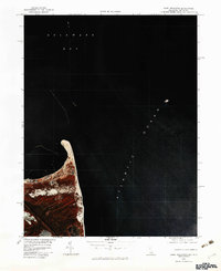
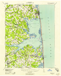
Cape Henlopen forms a distinctive hooked spit where the Delaware Bay meets the Atlantic Ocean in this 1980 color infrared orthophotograph. The imagery highlights the delicate interface of coastal dunes and vegetation at the mouth of the bay, just north of the historic maritime settlement of Lewes. Produced by the Geological Survey and the State of Delaware, this map uses infrared photography to provide a clear view of the land-water boundary and sediment patterns during the early 1980s. The specialized photography distinguishes between different types of coastal cover and marshland, offering a scientific perspective on the shifting sands of the Sussex County shoreline before modern development further altered the landscape.
Find a feature on this map
4 named features on this map. Tap any name to fly to it.
Don’t see what you’re looking for? This feature index may not catch every label — zoom into the map to look around manually.
Map Details
Editions of this 1980 Cape Henlopen Map
This is the sole edition of this map. No revisions or reprints were ever made.
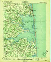
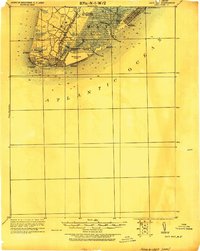
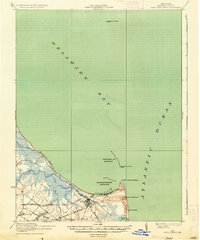
Other maps of this area

1888 · Cape May
USGS Topo · 1:62,500

1893 · Cape May
USGS Topo · 1:62,500

1898 · Cape May
USGS Topo · 1:62,500
1918 · Rehoboth
USGS Topo · 1:62,500

1918 · Cape Henlopen
USGS Topo · 1:62,500

1918 · Cape May
USGS Topo · 1:62,500
1925 · Cape May
USGS Topo · 1:62,500
1937 · Cape Henlopen
USGS Topo · 1:62,500
1938 · Rehoboth
USGS Topo · 1:62,500
1940 · Cape May
USGS Topo · 1:62,500