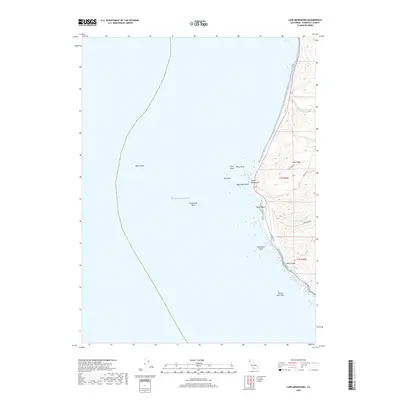
2018 Map of Cape Mendocino
USGS Topo · Published 2018About this map
Cape Mendocino stands as the westernmost point of California on this 2018 survey, where the terrestrial landscape of Humboldt County abruptly meets the Pacific Ocean. The coastline is defined by a dense cluster of offshore hazards, including the sprawling Blunts Reef and the isolated Fauntleroy Rock, which have long challenged Pacific navigation. Onshore, the terrain rises sharply from the beach into the heights of Cape Ridge, dissected by coastal drainages such as Bear River, Singley Creek, and Durr Creek. Transport through this steep, exposed environment is limited to the winding Mattole Rd and Cape Ridge Rd. Distinctive coastal landmarks like Sugarloaf Island, Steamboat Rock, and the passage at Devils Gate provide essential visual anchors for both maritime and land-based study of this uniquely positioned geographic terminus.
Find a feature on this map
20 named features on this map. Tap any name to fly to it.
Don’t see what you’re looking for? This feature index may not catch every label — zoom into the map to look around manually.
Map Details
Editions of this 2018 Cape Mendocino Map
This is the sole edition of this map. No revisions or reprints were ever made.
Other maps of this area

1916 · Cape Fortunas
USGS Topo · 1:62,500

1921 · Cape Mendocino
USGS Topo · 1:62,500

1943 · Ferndale
USGS Topo · 1:62,500

1949 · Eureka
USGS Topo · 1:250,000

1950 · Cape Mendocino
USGS Topo · 1:62,500

1951 · Cape Mendocino
USGS Topo · 1:62,500

1951 · Ferndale
USGS Topo · 1:62,500

1958 · Eureka
USGS Topo · 1:250,000
1958 · Eureka
USGS Topo · 1:250,000
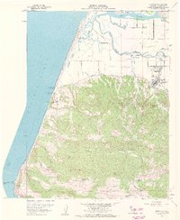
1959 · Ferndale
USGS Topo · 1:24,000