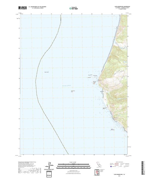
2021 Map of Cape Mendocino
USGS Topo · Published 2021About this map
Cape Mendocino dominates this Pacific coast landscape, representing the westernmost point of the California mainland. The map illustrates a dramatic meeting of land and sea where the steep slopes of Cape Ridge descend toward a coastline littered with navigational hazards. Offshore, the seabed rises in complex formations including the expansive Blunts Reef and isolated peaks like Fauntleroy Rock. Inland, the terrain is defined by sharp elevation changes and the drainages of Bear River and Singley Cr. Human presence is marked by the winding path of Mattole Rd and Cape Ridge Rd, which navigate the contours above the shore. Notable coastal landmarks such as Sugarloaf Island, Steamboat Rock, and Devils Gate serve as critical reference points along this exposed section of Humboldt County.
Find a feature on this map
20 named features on this map. Tap any name to fly to it.
Don’t see what you’re looking for? This feature index may not catch every label — zoom into the map to look around manually.
Map Details
Editions of this 2021 Cape Mendocino Map
This is the sole edition of this map. No revisions or reprints were ever made.
Other maps of this area

1916 · Cape Fortunas
USGS Topo · 1:62,500

1921 · Cape Mendocino
USGS Topo · 1:62,500

1943 · Ferndale
USGS Topo · 1:62,500

1949 · Eureka
USGS Topo · 1:250,000

1950 · Cape Mendocino
USGS Topo · 1:62,500

1951 · Cape Mendocino
USGS Topo · 1:62,500

1951 · Ferndale
USGS Topo · 1:62,500

1958 · Eureka
USGS Topo · 1:250,000
1958 · Eureka
USGS Topo · 1:250,000
1959 · Ferndale
USGS Topo · 1:24,000