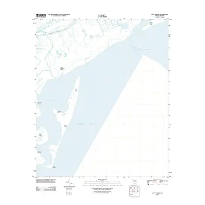
2011 Map of Cape Romain
USGS Topo · Published 2011About this map
Cape Romain Lighthouses stand as sentinels over this coastal landscape where the South Santee River meets the Atlantic Ocean. The geography is defined by a series of barrier islands and expansive tidal waters, including Murphy Island, Cape Island, and the sheltered waters of Cape Romain Harbor. This 2011 survey captures the intricate network of tidal creeks such as Needles Eye Creek and Alligator Creek that lattice the marshland between the mainland and the sea.
Find a feature on this map
19 named features on this map. Tap any name to fly to it.
Don’t see what you’re looking for? This feature index may not catch every label — zoom into the map to look around manually.
Map Details
Editions of this 2011 Cape Romain Map
This is the sole edition of this map. No revisions or reprints were ever made.
Other maps of this area

1942 · Cape Romain
USGS Topo · 1:24,000

1942 · Mc Clellanville
USGS Topo · 1:24,000

1942 · Santee Point
USGS Topo · 1:24,000

1943 · Santee
USGS Topo · 1:24,000

1943 · Minim Island
USGS Topo · 1:24,000

1948 · James Island
USGS Topo · 1:250,000

1949 · Georgetown
USGS Topo · 1:250,000

1967 · Georgetown
USGS Topo · 1:250,000
1968 · James Island
USGS Topo · 1:250,000
1969 · James Island
USGS Topo · 1:250,000