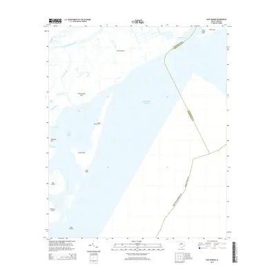
2014 Map of Cape Romain
USGS Topo · Published 2014About this map
Lighthouse Island and the sweeping curvature of Cape Romain define this coastal landscape along the South Carolina shoreline. The environment is a complex network of barrier islands, tidal creeks, and maritime features, including Murphy Island and Cape Island. The Intracostal Waterway cuts through the upper portion of the survey area, providing a protected passage behind the barrier system that separates the mainland from the Atlantic Ocean.
Find a feature on this map
26 named features on this map. Tap any name to fly to it.
Don’t see what you’re looking for? This feature index may not catch every label — zoom into the map to look around manually.
Map Details
Editions of this 2014 Cape Romain Map
This is the sole edition of this map. No revisions or reprints were ever made.
Other maps of this area

1942 · Cape Romain
USGS Topo · 1:24,000

1942 · Mc Clellanville
USGS Topo · 1:24,000

1942 · Santee Point
USGS Topo · 1:24,000

1943 · Santee
USGS Topo · 1:24,000

1943 · Minim Island
USGS Topo · 1:24,000

1948 · James Island
USGS Topo · 1:250,000

1949 · Georgetown
USGS Topo · 1:250,000

1967 · Georgetown
USGS Topo · 1:250,000
1968 · James Island
USGS Topo · 1:250,000
1969 · James Island
USGS Topo · 1:250,000