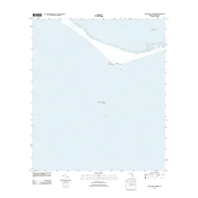
2012 Map of Cape Saint George
USGS Topo · Published 2012About this map
Cape Saint George Light House stands as a sentinel along the southern edge of the barrier island chain protecting the Florida coast. This 2012 survey captures the shifting sands and delicate maritime geography of Cape Saint George, where the land meets the expansive Gulf of Mexico. The map details the transition from the sheltered waters of Apalachicola Bay and Horseshoe Cove to the open sea, marked by submerged hazards such as Cape Saint George Shoal and Higgins Shoal. At the western edge, the opening of West Pass provides a critical navigation point for maritime traffic entering the bay. This study of the island's southern tip emphasizes the intersection of navigation history and coastal geomorphology in a region defined by its exposure to the elements.
Find a feature on this map
8 named features on this map. Tap any name to fly to it.
Don’t see what you’re looking for? This feature index may not catch every label — zoom into the map to look around manually.
Map Details
Editions of this 2012 Cape Saint George Map
This is the sole edition of this map. No revisions or reprints were ever made.
Other maps of this area

1943 · West Pass
USGS Topo · 1:31,680

1943 · Apalachicola
USGS Topo · 1:31,680

1943 · Indian Pass
USGS Topo · 1:24,000

1944 · Apalachicola
USGS Topo · 1:24,000

1945 · Cape St. George
USGS Topo · 1:31,680

1945 · Indian Pass
USGS Topo · 1:31,680

1949 · Apalachicola
USGS Topo · 1:250,000
1950 · New Inlet
USGS Topo · 1:31,680

1957 · Apalachicola
USGS Topo · 1:250,000

1959 · Apalachicola
USGS Topo · 1:250,000