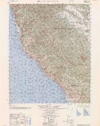
1962 Map of Cape San Martin
USGS Topo · Published 1962About this map
The Santa Lucia Range dominates this coastal landscape, where the steep mountains of the Los Padres National Forest meet the Pacific Ocean. Early 1960s land use is defined by a mix of wilderness recreation and military activity, with the Hunter Liggett Military Reservation occupying a significant portion of the interior high ground. Coastal life centers on small outposts like Gorda and the Pacific Valley Station, while the rugged interior is accessed via the Nacimiento Road and the Coast Ridge Fire Road. The map documents a transition in the local economy from isolated ranching, represented by San Miguelito Ranch and Krenke Ranch, toward forest management and public recreation at sites like Alder Creek Public Campground and the Salmon Creek Ranger Sta. High peaks such as Chalk Peak and Silver Peak overlook deep drainages including Davis Canyon and the Redwood Gulch.
Find a feature on this map
51 named features on this map. Tap any name to fly to it.
Don’t see what you’re looking for? This feature index may not catch every label — zoom into the map to look around manually.
Map Details
Editions of this 1962 Cape San Martin Map
This is the sole edition of this map. No revisions or reprints were ever made.
Other maps of this area

1919 · King City
USGS Topo · 1:62,500

1919 · Junipero Serra
USGS Topo · 1:62,500

1919 · Bryson
USGS Topo · 1:62,500

1919 · Piedras Blancas
USGS Topo · 1:62,500

1919 · San Simeon
USGS Topo · 1:62,500

1921 · Cape San Martin
USGS Topo · 1:62,500

1921 · Lucia
USGS Topo · 1:62,500

1927 · Piedras Blancas
USGS Topo · 1:62,500

1937 · San Simeon
USGS Topo · 1:62,500

1939 · King City
USGS Topo · 1:62,500