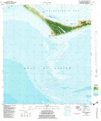
1982 Map of Cape St George
USGS Topo · Published 1983About this map
Little St George Island forms a protective barrier between the Gulf of Mexico and the southern reaches of Apalachicola Bay. This 1982 orthophotomap, based on aerial photography from the mid-1970s, depicts a landscape largely defined by the Cape St George State Preserve. The island's geography is punctuated by the historical site of the Lighthouse at Cape St George, a critical navigational landmark for vessels navigating through West Pass.
Find a feature on this map
12 named features on this map. Tap any name to fly to it.
Don’t see what you’re looking for? This feature index may not catch every label — zoom into the map to look around manually.
Map Details
Editions of this 1982 Cape St George Map
This is the sole edition of this map. No revisions or reprints were ever made.
Other maps of this area

1943 · West Pass
USGS Topo · 1:31,680

1943 · Apalachicola
USGS Topo · 1:31,680

1943 · Indian Pass
USGS Topo · 1:24,000

1944 · Apalachicola
USGS Topo · 1:24,000

1945 · Cape St. George
USGS Topo · 1:31,680

1945 · Indian Pass
USGS Topo · 1:31,680

1949 · Apalachicola
USGS Topo · 1:250,000
1950 · New Inlet
USGS Topo · 1:31,680

1957 · Apalachicola
USGS Topo · 1:250,000

1959 · Apalachicola
USGS Topo · 1:250,000