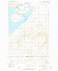
1948 Map of Capeneys Lake
USGS Topo · Published 1948About this map
The Medicine Lake Migratory Waterfowl Refuge dominates this northeastern Montana landscape, where the waters of Medicine Lake and Capeneys Lake provide a critical sanctuary for regional bird populations. The terrain is marked by essential rural infrastructure from the late 1940s, including Gaffney Pass and the notable Rock Crossing north of the lake. Educational life is documented by the presence of the Beverly Sch and Hammond Sch near the southern boundary, which marks the line between Sheridan and Roosevelt counties. This survey, compiled from 1946 aerial photography and plane-table methods, captures the high-plains environment before significant modern development, featuring scattered Windmills and a Lookout Tower that served as vital landmarks for local ranchers and land managers in this open country.
Find a feature on this map
11 named features on this map. Tap any name to fly to it.
Don’t see what you’re looking for? This feature index may not catch every label — zoom into the map to look around manually.
Map Details
Editions of this 1948 Capeneys Lake Map
2 editions found
Other maps of this area

1946 · Dagmar
USGS Topo · 1:24,000

1947 · Capeneys Lake
USGS Topo · 1:24,000

1948 · Capeneys Lake
USGS Topo · 1:24,000

1948 · Dagmar
USGS Topo · 1:24,000

1948 · Reserve SE
USGS Topo · 1:24,000

1948 · Sunnyhill School
USGS Topo · 1:24,000

1948 · Medicine Lake
USGS Topo · 1:24,000

1948 · Reserve
USGS Topo · 1:24,000

1949 · Reserve SE
USGS Topo · 1:24,000

1949 · Sunnyhill School
USGS Topo · 1:24,000