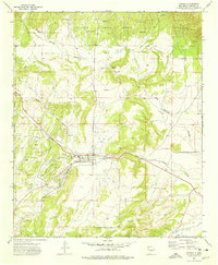
1973 Map of Capitan
USGS Topo · Published 1978About this map
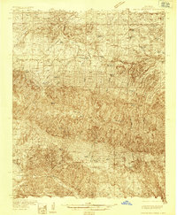
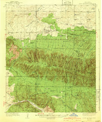
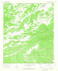
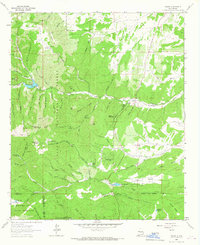
Capitan serves as the focal point of this high-desert landscape in the early 1970s, where the structured grid of the town meets the winding courses of Magado Creek and Salado Creek. The area’s ranching and mining heritage is evident through named properties like Flatley Ranch and Tinsley Ranch, alongside a small Cem and evidence of local industry at Coalora. The terrain is defined by the southern reaches of the Capitan Mountains, with the Lincoln National Forest covering much of the northern half of the quadrangle.
Find a feature on this map
34 named features on this map. Tap any name to fly to it.
Don’t see what you’re looking for? This feature index may not catch every label — zoom into the map to look around manually.
Map Details
Editions of this 1973 Capitan Map
This is the sole edition of this map. No revisions or reprints were ever made.
Other maps of this area

1934 · Capitan
USGS Topo · 1:48,000
1935 · Capitan Mountains
USGS Topo · 1:48,000

1937 · Capitan
USGS Topo · 1:62,500
1940 · Capitan Mountains
USGS Topo · 1:62,500

1955 · Roswell
USGS Topo · 1:250,000

1958 · Roswell
USGS Topo · 1:250,000

1961 · Lincoln
USGS Topo · 1:62,500

1962 · Roswell
USGS Topo · 1:250,000
1963 · Fort Stanton
USGS Topo · 1:24,000
1963 · Angus
USGS Topo · 1:24,000