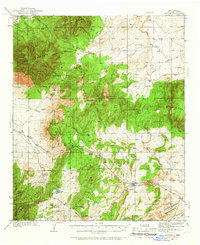
1934 Map of Capitan
USGS Topo · Published 1965About this map
Lincoln National Forest dominates this mid-1930s landscape, where rugged terrain and specialized facilities reflect a diverse mountain economy. The village of Capitan serves as a local hub near the U. S. Marine Hospital Reservation, while the mining history of the region is evident at Mine Camp and the infrastructure of White Oaks, which includes a Power Plant. Settlements like Nogal and scattered family holdings such as Le Baron Ranch and Phillips Ranch are connected by primitive routes like the Canyon Trail.
Find a feature on this map
44 named features on this map. Tap any name to fly to it.
Don’t see what you’re looking for? This feature index may not catch every label — zoom into the map to look around manually.
Map Details
Editions of this 1934 Capitan Map
3 editions found
Other maps of this area

1934 · Capitan
USGS Topo · 1:48,000

1935 · Capitan Mountains
USGS Topo · 1:48,000

1937 · Capitan
USGS Topo · 1:62,500

1938 · Carrizozo
USGS Topo · 1:48,000

1940 · Capitan Mountains
USGS Topo · 1:62,500

1943 · Carrizozo
USGS Topo · 1:62,500

1950 · Carrizozo
USGS Topo · 1:62,500

1950 · Little Black Peak
USGS Topo · 1:62,500

1950 · Sierra Blanca Peak
USGS Topo · 1:62,500

1955 · Roswell
USGS Topo · 1:250,000