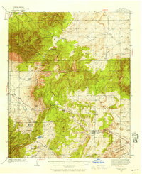
1934 Map of Capitan
USGS Topo · Published 1958About this map
The high-desert terrain of Lincoln County unfolds across this mid-century publication of a 1934 survey, centered on the settlement of Capitan. The map details a transition from the mountainous heights of Carrizo Mountain and the Sacramento Mountains to the lower basins, anchored by the U.S. Marine Hospital Reservation in the southeast. A significant network of ranches and small settlements like White Oaks and Nogal are visible, alongside infrastructure such as a Power Plant and a Landing Field.
Find a feature on this map
49 named features on this map. Tap any name to fly to it.
Don’t see what you’re looking for? This feature index may not catch every label — zoom into the map to look around manually.
Map Details
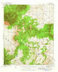
Editions of this 1934 Capitan Map
3 editions found
Other maps of this area

1934 · Capitan
USGS Topo · 1:48,000

1935 · Capitan Mountains
USGS Topo · 1:48,000

1937 · Capitan
USGS Topo · 1:62,500

1938 · Carrizozo
USGS Topo · 1:48,000

1940 · Capitan Mountains
USGS Topo · 1:62,500

1943 · Carrizozo
USGS Topo · 1:62,500

1950 · Carrizozo
USGS Topo · 1:62,500

1950 · Little Black Peak
USGS Topo · 1:62,500

1950 · Sierra Blanca Peak
USGS Topo · 1:62,500

1955 · Roswell
USGS Topo · 1:250,000