
1923 Map of Capon Bridge
USGS Topo · Published 1923About this map
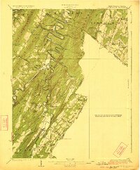
The Cacapon River carves a dramatic, winding path through the ridge-and-valley landscape of the West Virginia-Virginia borderlands. This 1923 edition highlights a rural economy centered on the river and the Northwestern Turnpike, which serves as the primary artery through the southern portion of the map. The distribution of educational and religious institutions, such as Woodrow School, Victory School, and Capon Chapel, reflects a series of small, self-contained communities separated by the steep elevation of Cacapon Mountain and Timber Ridge. Notable landmarks like Castle Rock and Darbys Nose define the local topography, while numerous small runs and hollows like Frog Hollow and Critton Run drain into the main river systems. The inclusion of remote settlements such as Forks of Cacapon and Largent provides an essential resource for genealogists researching family ties in this border region during the early twentieth century.
Find a feature on this map
76 named features on this map. Tap any name to fly to it.
Don’t see what you’re looking for? This feature index may not catch every label — zoom into the map to look around manually.
Map Details
Editions of this 1923 Capon Bridge Map
2 editions found
Other maps of this area

1891 · Romney
USGS Topo · 1:125,000

1894 · Winchester
USGS Topo · 1:125,000

1898 · Paw Paw
USGS Topo · 1:62,500

1899 · Flintstone
USGS Topo · 1:62,500

1899 · Hancock
USGS Topo · 1:62,500

1900 · Pawpaw
USGS Topo · 1:62,500

1900 · Flintstone
USGS Topo · 1:62,500

1901 · Hancock
USGS Topo · 1:62,500

1910 · Paw Paw
USGS Topo · 1:62,500

1914 · Gerrardstown
USGS Topo · 1:48,000