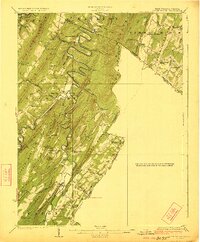
1923 Map of Capon Bridge
USGS Topo · Published 1923About this map
The Cacapon River winds in dramatic loops through the ridges of Hampshire and Morgan Counties, carving a path through Bloomery Mountain and Castle Mountain. This topographic survey, based on field work by E.I. Ireland, D.H. Watson, and C.W. Arnold, details a landscape defined by its river-valley settlements and mountain gaps. The southern portion of the map is anchored by the crossing at Capon Bridge along the Northwestern Turnpike, a vital historic corridor through the Appalachian highlands.
Find a feature on this map
73 named features on this map. Tap any name to fly to it.
Don’t see what you’re looking for? This feature index may not catch every label — zoom into the map to look around manually.
Map Details
Editions of this 1923 Capon Bridge Map
2 editions found

Other maps of this area

1891 · Romney
USGS Topo · 1:125,000

1894 · Winchester
USGS Topo · 1:125,000

1898 · Paw Paw
USGS Topo · 1:62,500

1899 · Flintstone
USGS Topo · 1:62,500

1899 · Hancock
USGS Topo · 1:62,500

1900 · Pawpaw
USGS Topo · 1:62,500

1900 · Flintstone
USGS Topo · 1:62,500

1901 · Hancock
USGS Topo · 1:62,500

1910 · Paw Paw
USGS Topo · 1:62,500

1914 · Gerrardstown
USGS Topo · 1:48,000