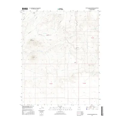
2017 Map of Captain Davis Mountain
USGS Topo · Published 2017About this map
Captain Davis Mountain and Lone Mtn dominate the high desert terrain of southern Santa Fe County in this 2017 survey. The landscape is defined by its complex drainage network, where ephemeral watercourses like Arroyo la Joya and Arroyo San Lazaro carve through the high-elevation basin. These features, along with names like Peach Spring and Cañamo Spring, indicate the vital locations of water in an otherwise arid environment.
Find a feature on this map
29 named features on this map. Tap any name to fly to it.
Don’t see what you’re looking for? This feature index may not catch every label — zoom into the map to look around manually.
Map Details
Editions of this 2017 Captain Davis Mountain Map
This is the sole edition of this map. No revisions or reprints were ever made.
Other maps of this area

1892 · San Pedro
USGS Topo · 1:125,000

1894 · Lamy
USGS Topo · 1:125,000

1954 · San Pedro
USGS Topo · 1:24,000

1954 · Santa Fe
USGS Topo · 1:250,000

1956 · Edgewood
USGS Topo · 1:62,500

1958 · Santa Fe
USGS Topo · 1:250,000

1958 · Albuquerque
USGS Topo · 1:250,000

1960 · Stanley
USGS Topo · 1:62,500

1961 · Madrid
USGS Topo · 1:62,500

1962 · Albuquerque
USGS Topo · 1:250,000