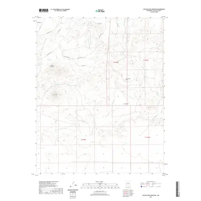
2020 Map of Captain Davis Mountain
USGS Topo · Published 2020About this map
Captain Davis Mtn and Lone Mtn anchor this high-desert landscape in southern Santa Fe County, where drainage systems like Cunningham Cr and Arroyo San Lazaro define the topography. The terrain transitions from the elevated Los Cobreros Mesa down to the expansive La Joya Flats, highlighting the dry-land drainage patterns of the Galisteo Basin area. Named water sources such as Peach Spring, Cañamo Spring, and the Upper Rock Tank indicate the vital, scattered points of water essential for ranching and settlement in this arid environment. The map details a network of modern rural access roads and historic routes, including Wagon Trail Rd and Pioneer Way, which cut through the various arroyos. This survey provides a clear look at the contemporary land division and named geographical landmarks that have long shaped navigation and land use in this part of New Mexico.
Find a feature on this map
28 named features on this map. Tap any name to fly to it.
Don’t see what you’re looking for? This feature index may not catch every label — zoom into the map to look around manually.
Map Details
Editions of this 2020 Captain Davis Mountain Map
This is the sole edition of this map. No revisions or reprints were ever made.
Other maps of this area

1892 · San Pedro
USGS Topo · 1:125,000

1894 · Lamy
USGS Topo · 1:125,000

1954 · San Pedro
USGS Topo · 1:24,000

1954 · Santa Fe
USGS Topo · 1:250,000

1956 · Edgewood
USGS Topo · 1:62,500

1958 · Santa Fe
USGS Topo · 1:250,000

1958 · Albuquerque
USGS Topo · 1:250,000

1960 · Stanley
USGS Topo · 1:62,500

1961 · Madrid
USGS Topo · 1:62,500

1962 · Albuquerque
USGS Topo · 1:250,000