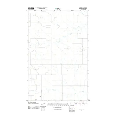
2011 Map of Carbert
USGS Topo · Published 2011About this map
Carbert sits at the heart of this rural Montana landscape along the international border, where the high plains transition into a network of vital seasonal drainages. The area is defined by its agricultural grid and the natural meandering paths of Coal Creek and Butte Creek, which dictate the local topography and placement of rural homesteads. This 2011 survey illustrates the endurance of the northern homesteading legacy, where the road network, including County Rd and Roseberry Rd, serves as the primary skeleton for isolated settlements. The presence of Lewarton Coulee in the southwest further highlights the characteristic dry-wash geography of Daniels County, a region where life and transport are closely tied to the subtle contours of the watershed.
Find a feature on this map
7 named features on this map. Tap any name to fly to it.
Don’t see what you’re looking for? This feature index may not catch every label — zoom into the map to look around manually.
Map Details
Editions of this 2011 Carbert Map
This is the sole edition of this map. No revisions or reprints were ever made.
Other maps of this area

1954 · Wolf Point
USGS Topo · 1:250,000

1958 · Wolf Point
USGS Topo · 1:250,000

1973 · Horseshoe Basin
USGS Topo · 1:24,000

1973 · Peerless
USGS Topo · 1:24,000

1973 · Flaherty Coulee
USGS Topo · 1:24,000

1973 · Carbert
USGS Topo · 1:24,000

1973 · Killenbeck Reservoir
USGS Topo · 1:24,000

1973 · Four Buttes NW
USGS Topo · 1:24,000

1983 · Scobey
USGS Topo · 1:100,000
2011 · Horseshoe Basin
USGS Topo · 1:24,000