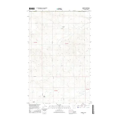
2017 Map of Carbert
USGS Topo · Published 2017About this map
The high plains of northeast Montana define this landscape, where the small settlement of Carbert sits at the junction of Carbert Rd and Coal Creek Rd. In this rural expanse of Daniels County, the terrain is shaped by the drainage patterns of Coal Cr and Butte Cr, which flow through the undulating northern prairie. To the southwest, the distinctive landform of Lewarton Coulee cuts into the plains near the small community of Butte Creek. The map reflects a structured grid of section lines and gravel roads, including French Ln and Hammerberg Rd, that provide access to the remote agricultural allotments. These township and range divisions, such as t37n r45e, illustrate the enduring homestead-era land patterns that still govern this portion of the Montana-Saskatchewan border region.
Find a feature on this map
17 named features on this map. Tap any name to fly to it.
Don’t see what you’re looking for? This feature index may not catch every label — zoom into the map to look around manually.
Map Details
Editions of this 2017 Carbert Map
This is the sole edition of this map. No revisions or reprints were ever made.
Other maps of this area

1954 · Wolf Point
USGS Topo · 1:250,000

1958 · Wolf Point
USGS Topo · 1:250,000

1973 · Horseshoe Basin
USGS Topo · 1:24,000

1973 · Peerless
USGS Topo · 1:24,000

1973 · Flaherty Coulee
USGS Topo · 1:24,000

1973 · Carbert
USGS Topo · 1:24,000

1973 · Killenbeck Reservoir
USGS Topo · 1:24,000

1973 · Four Buttes NW
USGS Topo · 1:24,000

1983 · Scobey
USGS Topo · 1:100,000
2011 · Horseshoe Basin
USGS Topo · 1:24,000