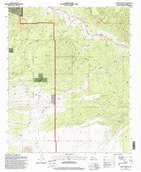
1995 Map of Carbon Springs
USGS Topo · Published 1998About this map
The Rio Salado carves a broad path through the northern reach of this landscape, its wide, braided bed defining the geography of northern Socorro County. To the west, the settlement of Riley sits near the head of Tanque Canyon, while the southern expanse is dominated by the complex terrain of the Cibola National Forest. This 1990s field survey documents a legacy of mountain industry and ranching, most notably at East Mill and the East New Mill further south. The land is defined by a network of seasonal water sources and deep incisions like Cañon de las Cabras and Cedar Canyon. Ranching life is anchored by the Gray and Ligon Ranch in the southeast, while numerous named water points like Carbon Springs, Boulder Springs, and Bear Springs highlight the critical importance of reliable water in this arid environment along the New Mexico Base Line.
Find a feature on this map
22 named features on this map. Tap any name to fly to it.
Don’t see what you’re looking for? This feature index may not catch every label — zoom into the map to look around manually.
Map Details
Editions of this 1995 Carbon Springs Map
This is the sole edition of this map. No revisions or reprints were ever made.
Other maps of this area

1954 · Socorro
USGS Topo · 1:250,000

1958 · Socorro
USGS Topo · 1:250,000

1959 · Magdalena
USGS Topo · 1:62,500

1959 · Riley
USGS Topo · 1:62,500

1962 · Socorro
USGS Topo · 1:250,000

1964 · La Jara Peak
USGS Topo · 1:24,000

1964 · Silver Hill
USGS Topo · 1:24,000
1964 · Mesa Cencerro
USGS Topo · 1:24,000
1979 · Magdalena
USGS Topo · 1:100,000
1985 · Ladron Peak
USGS Topo · 1:24,000