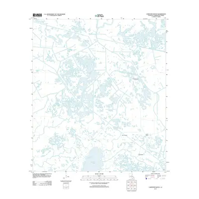
2012 Map of Carencro Bayou
USGS Topo · Published 2012About this map
Carencro Lake and its surrounding wetlands define this portion of the Louisiana coast, where a complex network of waterways dominates the landscape. The geography is characterized by numerous bayous, including the primary Carencro Bayou and Bayou Penchant, which snake through a mix of open water and low-lying land. In this industrial marshland, the Bayou Penchant Oil and Gas Field indicates the importance of resource extraction to the local economy. Named features like Biscuit Island, Hebert Island, and Lovell Island rise slightly from the surrounding waters, providing recognizable landmarks for those navigating the intricate channels of Creole Bayou and Plumb Lake. The map reveals the sophisticated system of canals and water management required to maintain industry and navigation within the shifting tides and seasonal fluctuations of the Terrebonne Parish basin.
Find a feature on this map
11 named features on this map. Tap any name to fly to it.
Don’t see what you’re looking for? This feature index may not catch every label — zoom into the map to look around manually.
Map Details
Editions of this 2012 Carencro Bayou Map
This is the sole edition of this map. No revisions or reprints were ever made.
Other maps of this area

1892 · Gibson
USGS Topo · 1:62,500

1894 · Bayou De Large
USGS Topo · 1:62,500

1897 · Gibson
USGS Topo · 1:62,500

1932 · Lake Decade
USGS Topo · 1:62,500

1935 · Morgan City
USGS Topo · 1:62,500

1935 · Lake Mechant
USGS Topo · 1:31,680

1935 · Lake Penchant
USGS Topo · 1:31,680

1939 · Gibson
USGS Topo · 1:62,500

1940 · Bayou Du Large
USGS Topo · 1:62,500

1941 · Bayou Du Large
USGS Topo · 1:62,500