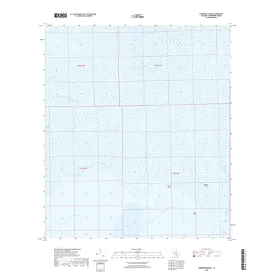
2018 Map of Carencro Bayou
USGS Topo · Published 2018About this map
Carencro Bayou and its surrounding wetlands define this landscape in Terrebonne Parish, Louisiana. This 2018 survey illustrates a complex network of coastal waterways including Bayou Penchant and Willow Bayou, where dry ground is rare. Named features like Hebert Island, Biscuit Island, and Lovell Island emerge from the marsh, providing essential reference points for navigation and local history. The presence of Carencro Lake and the engineered Voss Canal highlights the intersection of natural hydrology and human water management in the deep delta. This map serves as a detailed record of the shoreline and waterway configurations just before the turn of the decade, capturing a snapshot of a terrain dominated by Creole Bayou and Plumb Bayou.
Find a feature on this map
17 named features on this map. Tap any name to fly to it.
Don’t see what you’re looking for? This feature index may not catch every label — zoom into the map to look around manually.
Map Details
Editions of this 2018 Carencro Bayou Map
This is the sole edition of this map. No revisions or reprints were ever made.
Other maps of this area

1892 · Gibson
USGS Topo · 1:62,500

1894 · Bayou De Large
USGS Topo · 1:62,500

1897 · Gibson
USGS Topo · 1:62,500

1932 · Lake Decade
USGS Topo · 1:62,500

1935 · Morgan City
USGS Topo · 1:62,500

1935 · Lake Mechant
USGS Topo · 1:31,680

1935 · Lake Penchant
USGS Topo · 1:31,680

1939 · Gibson
USGS Topo · 1:62,500

1940 · Bayou Du Large
USGS Topo · 1:62,500

1941 · Bayou Du Large
USGS Topo · 1:62,500