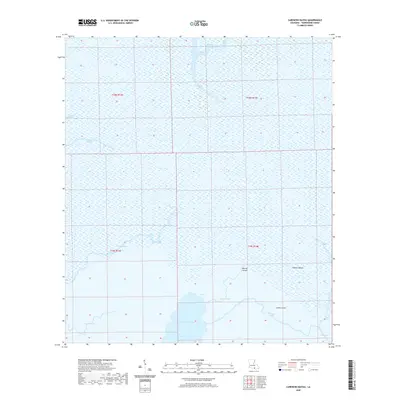
2020 Map of Carencro Bayou
USGS Topo · Published 2020About this map
Carencro Lake and its surrounding wetlands define this coastal landscape in southern Terrebonne Parish, Louisiana. The intricate network of waterways, including Bayou Penchant, Bayou Carencro, and Creole Bayou, illustrates a traditional deltaic environment where water takes precedence over land. Names like Biscuit Island, Hebert Island, and Lovell Island denote the few raised landforms stable enough to carry local identifiers, suggesting a history of seasonal use or subsistence living in these remote marshes. Evidence of industrial or transport modifications appears in the south with the Voss Canal, connecting larger water bodies. This 2020 survey by the U.S. Geological Survey provides an essential record of this shoreline's hydrography, capturing the state of Bayou de Log and Victors Bayou before further coastal change occurs.
Find a feature on this map
17 named features on this map. Tap any name to fly to it.
Don’t see what you’re looking for? This feature index may not catch every label — zoom into the map to look around manually.
Map Details
Editions of this 2020 Carencro Bayou Map
This is the sole edition of this map. No revisions or reprints were ever made.
Other maps of this area

1892 · Gibson
USGS Topo · 1:62,500

1894 · Bayou De Large
USGS Topo · 1:62,500

1897 · Gibson
USGS Topo · 1:62,500

1932 · Lake Decade
USGS Topo · 1:62,500

1935 · Morgan City
USGS Topo · 1:62,500

1935 · Lake Mechant
USGS Topo · 1:31,680

1935 · Lake Penchant
USGS Topo · 1:31,680

1939 · Gibson
USGS Topo · 1:62,500

1940 · Bayou Du Large
USGS Topo · 1:62,500

1941 · Bayou Du Large
USGS Topo · 1:62,500