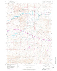
1949 Map of Careyhurst
USGS Topo · Published 1977About this map
The North Platte River winds through the northern portion of this landscape, serving as a primary corridor for both transportation and irrigation during the mid-20th century. Parallel railroad lines, the Burlington Northern and the Chicago and Northwestern, flank the riverbanks, reflecting the region's reliance on rail for moving goods and people through Converse County. Small settlements and industrial stops like Careyhurst, Welch, and Clayton are situated along these tracks, while the local ranching economy is represented by the sprawling Careyhurst Ranch.
Find a feature on this map
22 named features on this map. Tap any name to fly to it.
Don’t see what you’re looking for? This feature index may not catch every label — zoom into the map to look around manually.
Map Details
Editions of this 1949 Careyhurst Map
2 editions found
Other maps of this area

1949 · Orpha
USGS Topo · 1:24,000

1949 · Careyhurst
USGS Topo · 1:24,000

1949 · Gilbert Lake
USGS Topo · 1:24,000

1949 · Glenrock
USGS Topo · 1:24,000

1949 · Leuenberger Ranch
USGS Topo · 1:24,000

1949 · Hylton Ranch
USGS Topo · 1:24,000

1950 · Careyhurst
USGS Topo · 1:24,000

1950 · Gilbert Lake
USGS Topo · 1:24,000

1950 · Leuenberger Ranch
USGS Topo · 1:24,000

1950 · Orpha
USGS Topo · 1:24,000